Evacuations, school closures and rail chaos as rain bomb hits NSW
Severe heavy rain and flooding in northern NSW mean wild oceans, dangerous stormwater drains and more – those in affected areas should follow instructions, keep off roads and stay safe

READING LEVEL: GREEN
At least 68 schools have been closed and more than 1600 State Emergency Service (SES) personnel deployed* in NSW, with forecasters warning the state’s severe weather could persist for several more days.
Evacuation* warnings have now been issued for several communities, including Dungog, Paterson and Forster.
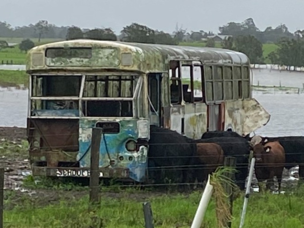
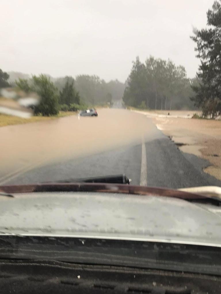
In the past 36 hours, there have been more than 24 flood rescues across the Hunter and Mid North Coast regions, mostly involving people driving through floodwaters.
“I don’t know how many times I have to say this: do not drive through floodwaters,” Minister for Emergency Services Jihad Dib said.
“We need people to be sensible and follow instructions and be cautious*.”

SAFETY FIRST
“Don’t drive, ride or walk through floodwater,” the SES said.
“If you are trapped by flash flooding, seek refuge in the highest available place and ring triple-0 if you need rescue.”
Stormwater drains are extremely hazardous during heavy rain and floods – children are advised to please keep well clear at all times.
Residents of all ages are urged to avoid impacted areas and never attempt to drive through floodwaters.
Public transport has also been affected, with buses replacing trains between Newcastle Interchange and Fassifern on the Central Coast and Newcastle Line due to flooding at Cockle Creek.
All trains on the Hunter Line have been suspended due to flooding at Sandgate.
Limited buses are operating but are unable to access some flood-affected stations.
If you live in an affected region and an adult in your family receives an evacuation notice due to rising flood conditions, the emergency alert advises residents to “evacuate to stay with family, friends, or alternate accommodation in areas unaffected by flooding”.
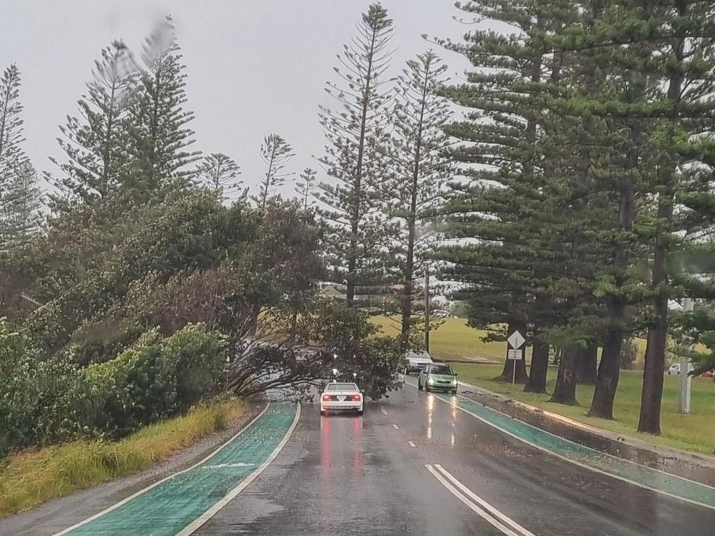
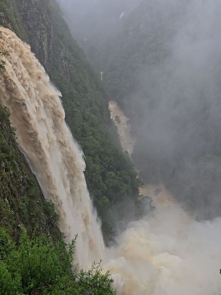
The severe storms have lashed northern NSW, triggering flash flooding, rescues, evacuations and widespread disruptions.
Evacuation centres are open at Wingham, Dungog, Taree and Bulahdelah.
Taree was hit by at least 267mm of rain over the past 36 hours, including 190mm in one six-hour period.
Volunteers are doorknocking highly affected areas, including low-lying areas of Wingham, as the Manning River continues to rise.
“The short intense bursts of rain that we expect will create further flash flooding and risk to the residents of the areas affected,” NSW SES northern zone commander Andrew Cribb said
“This flash flooding is hitting the ground that is absolutely saturated and running downhill towards our catchments, rivers and tributaries*, which will prolong any flooding.
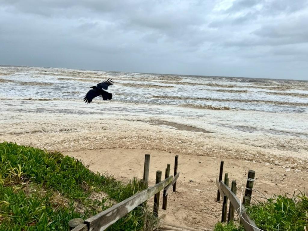
More than 1500 calls for assistance were made to the State Emergency Service (SES) in 24 hours to Tuesday afternoon, with the Hunter, Mid North Coast, Northern Tablelands, and North West Slopes and Plains among the hardest-hit regions.
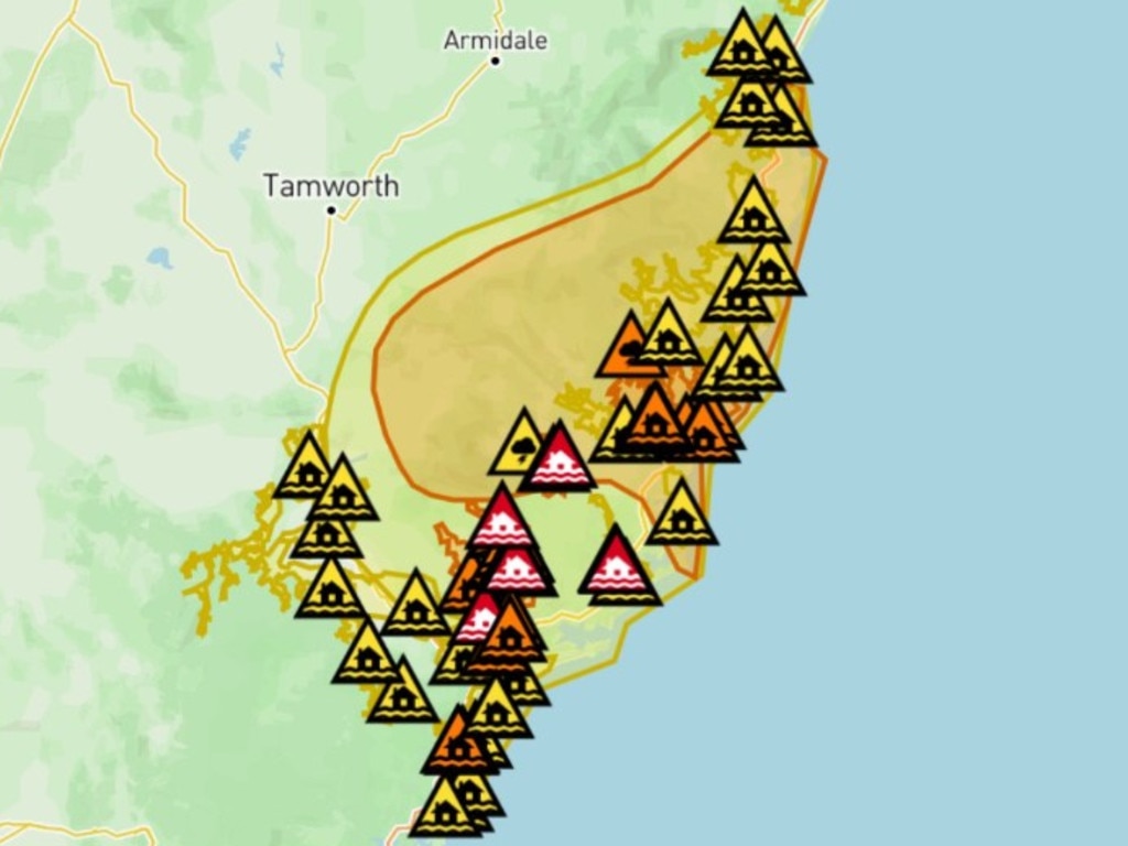
There was 200mm recorded in Port Macquarie since Monday morning and the Bureau of Meteorology said a deep, stationary coastal trough* continues to drive the extreme conditions.
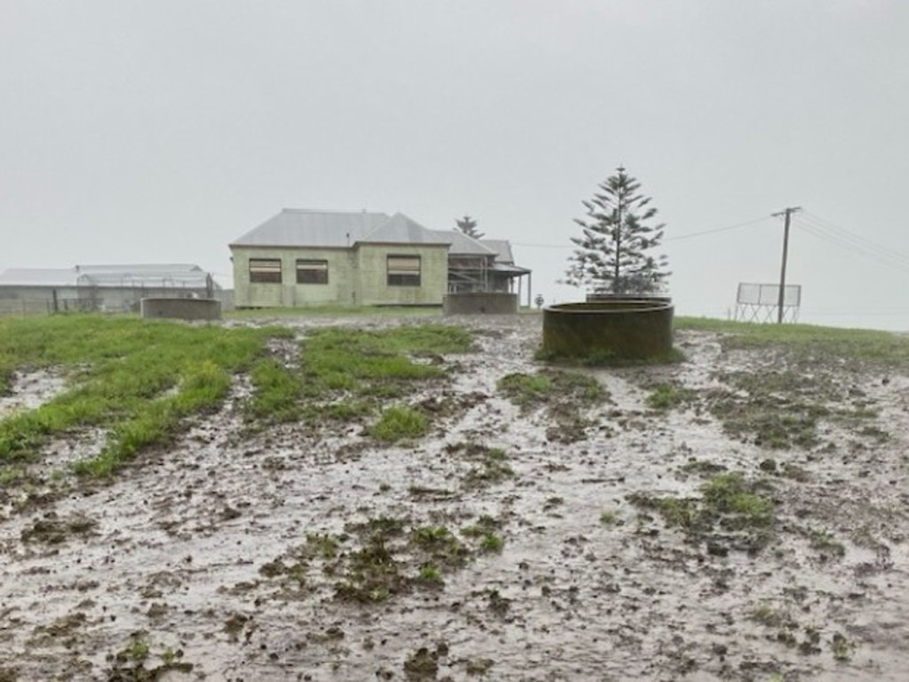
A separate hazardous surf warning is current between Cape Byron and the Sydney coast, with waves over five metres forecast offshore. People are advised to avoid beaches and coastal areas due to the risk of coastal erosion* and dangerous conditions.
“Beach conditions are incredibly dangerous,” said senior meteorologist* Sarah Scully. “People should stay well away from the surf and exposed areas, particularly along the Mid North Coast and Hunter coastline.”
Flood warnings are now in place for multiple rivers, including the Paterson, Williams and Goulburn rivers, and moderate flood warnings for the Hastings, Hunter and Wollombi.
POLL
GLOSSARY
- deployed: moved into position to act, posted or sent somewhere to perform their duties
- evacuation: moving people from a dangerous place to somewhere safe
- cautious: careful, aware, alert, mindful of risk and potential danger
- tributaries: river or stream that flows into a larger river or lake
- trough: a long, narrow region of low atmospheric pressure relative to the surrounding area
- erosion: occurs when earthen materials are worn away and moved by natural forces such as wind or water
- meteorologist: scientist who studies and forecasts weather, climate and atmospheric conditions
EXTRA READING
Of droughts and flooding rains
Peanut allergies linked to pollution
QUICK QUIZ
- What should you do if you are trapped in floodwaters?
- Kids are advised to keep well clear of what at all times?
- How much rain was recorded at Taree in one six-hour period?
- What is driving the conditions, according to the Bureau of Meteorology?
- Can you name three sites were evacuation centres have opened?
LISTEN TO THIS STORY
CLASSROOM ACTIVITIES
1. Design a flood safety kit
Describe or design a special flood safety kit that could be given to every home in affected areas. Use information in the story to give you ideas.
Time: allow at least 30 minutes to complete this activity
Curriculum Links: English, Science, Health and Physical Education
2. Extension
Do you know how and why flooding can develop? Use your research skills to find out. Use the information to create a set of diagrams or pictures that will help other kids understand exactly how and why floods happen.
Time: allow at least 40 minutes to complete this activity
Curriculum Links: English, Geography, Science
VCOP ACTIVITY
Opener up-level it
Make a list of all the openers in the article. Pick three that repeat and see if you can replace them with another word, or shuffle the order of the sentence to bring a new opener to the front.
Don’t forget to re-read the sentence to make sure it still makes sense, and that it actually sounds better.

