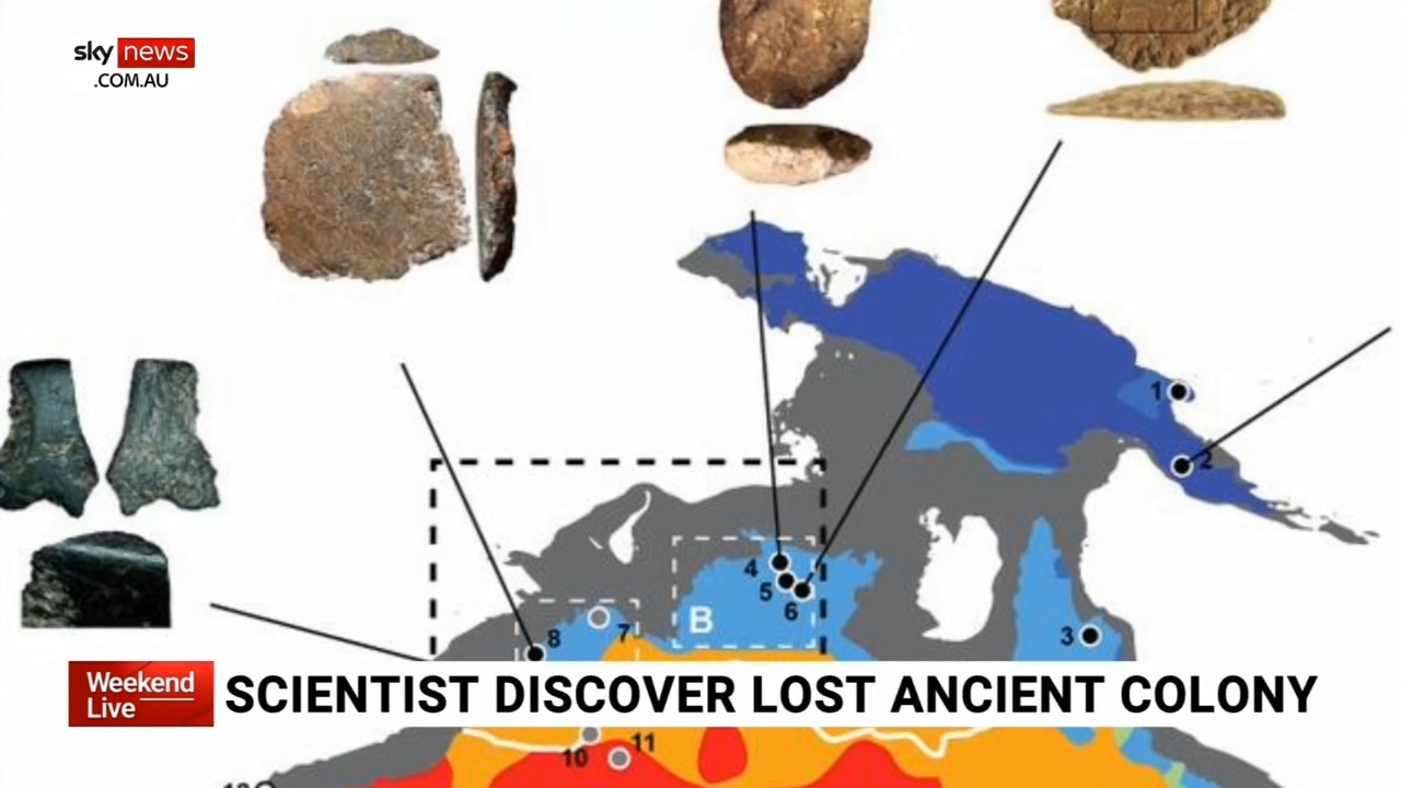
Map shows how Australia looked when humans discovered it
The first humans to set foot in Australia would have discovered a large, abundant continent where giant beasts roamed the land, according to a study on the ancient continent of ‘Sahul’

READING LEVEL: ORANGE
Bigger. Greener. Teeming with exotic life. This was what Australia looked like 75,000 years ago, according to a team of scientists mapping the history of the continent.
When the first hunter-gatherers crossed the narrow strait from East Timor – then at the tip of a much larger Southeast Asian landmass – they would have found a place unlike any other they had seen before.
Giant beasts would have roamed the land, and it would have had about two million square kilometres of lush coastal plains.
But when humans first discovered Australia, it would have already been slowly changing into the land we know today.
A joint team from the University of Sydney, Southern Cross University, Flinders University and Université Grenoble-Alpes has been studying this change.
They have created a computerised model that shows the evolution of the landscape over tens of thousands of years. The model shows how the climate changed over time and the impact these changes had on ecosystems across the continent – including how humans may have moved around.
Going back to when humans first entered the continent, much of the world’s oceans were frozen in the north and south poles. Landlocked glaciers were far larger than they are today. While glaciers were surrounded by land, sea levels did not rise high enough to spill across the continental shelf linking mainland Australia to Tasmania and Papua New Guinea. This single connected continent has been named “Sahul”.
About 25,000 years ago, sea levels began to rise, gradually separating Australia from Papua New Guinea and turning Tasmania into an island
Many First Nations campsites were washed out as seas rose between 80m and 120m to where they are today. Some of these have since been discovered and studied by archaeologists.
But who settled where, when – and why – has remained something of a mystery.
THE MAGICAL LAND OF “OZ”
The study identified two potential crossing points from Asia into Sahul that ancient seafarers could have taken.
One route was through West Papua (about 73,000 years ago) and down through northern Queensland and what is now the Gulf (then a lake) of Carpentaria.
Another was across the Timor Sea shelf (about 75,000 years ago) and into the Kimberley.
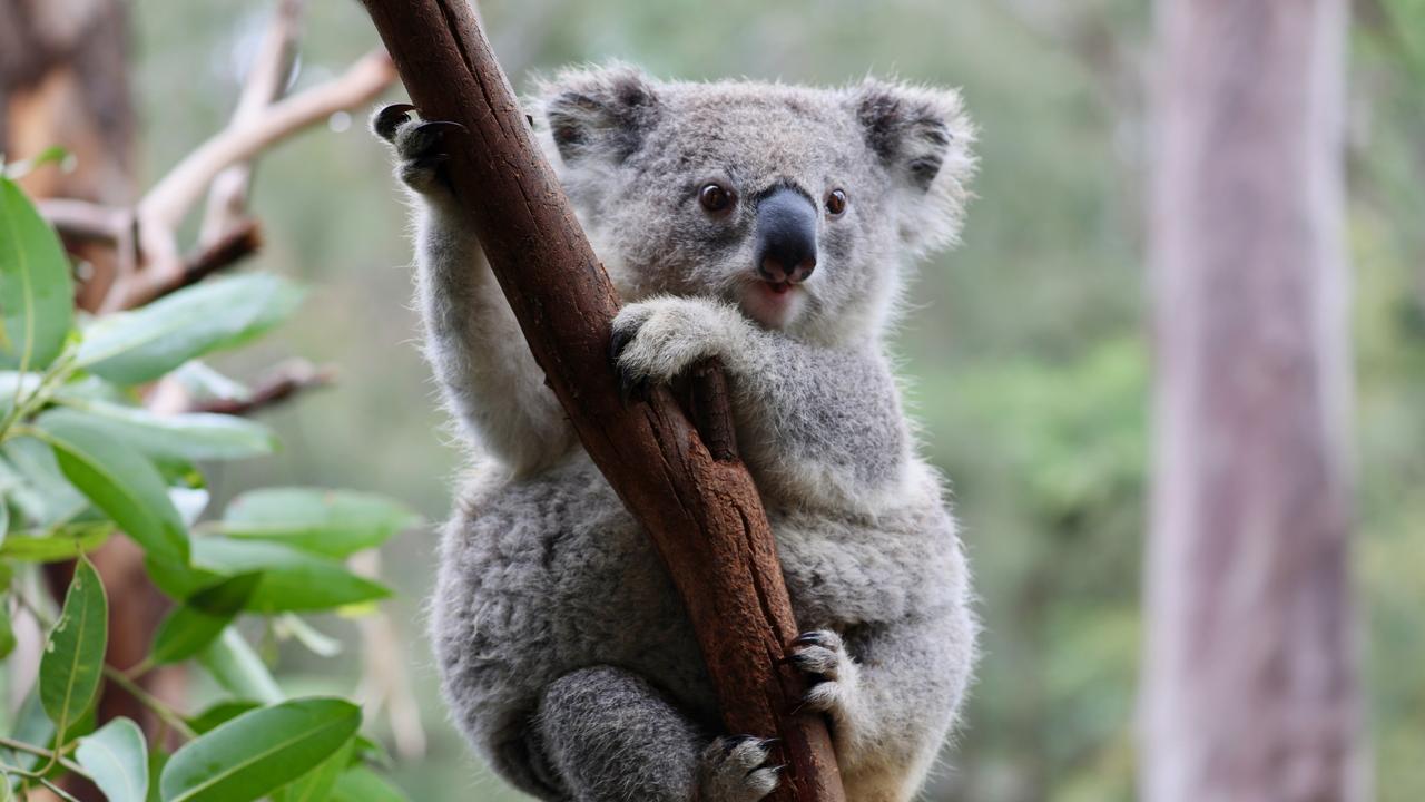
Giant iguanas. Giant kangaroos. Giant koalas.
These were scattered across the landscape. But scientists believe their numbers had already began to dwindle because the climate was changing to become more arid. The arrival of a new predator – humans – may have sped up their demise.
Last month, the Museums Victoria Research Institute revealed the remarkably well-preserved skeleton of a 50,000-year-old “short-faced” kangaroo.
Long extinct, it didn’t hop. It walked with what researchers describe as a “striding gait … similar to that of humans or Tyrannosaurus rex”.

FOLLOWING AND FLEEING WATER
Flinders University Associate Professor and co-author of the study Ian Moffat said the way the changing climate affected early humans of Sahul had previously been overlooked.
As Australia’s climate gradually shifted over millennia, Aboriginal settlers were forced to adapt. Sea levels rose. Temperatures warmed. The land began to dry out.
The new study ran thousands of simulations to determine where the landscape was most suitable for humans to live in at different points over the space of 40,000 years in order to map out possible migration routes.
When combined with dates studied from known archaeological sites, the simulations suggested First Nations peoples may have gradually grown their settlements at about 0.36km to 1.15km each year.
People would have lived along river systems on both sides of Lake Carpentaria, which is now the modern Gulf of Carpentaria, the study authors wrote.
“The first communities would have mainly been foraging along the way, following water streams,” they said.
THE DAWN OF FIRE MANAGEMENT
A separate study by James Cook University has shown fire management techniques used by First Nations people were invented at least 11,000 years ago. The use of controlled burning to manage Australia’s environment shifted the pattern away from one of big seasonal fires started by lightning strikes to less damaging “patchwork” burning.
Professor Michael Bird and his team took an 18-metre-deep sediment core from Girraween Lagoon on the outskirts of Darwin for the study. It showed there had been changes in pollen, sediment and charcoal concentrations over time as humans started using fire to maintain their environment.
“The Girraween record is one of the few long-term climate records that covers the period before people arrived in Australia 65,000 years ago, as well as after,” Prof Bird said.
Much of this traditional fire management stopped after the arrival of European settlers in the 1800s, which led to the return of high-intensity, late dry season bushfires.
The change would have been a big shock to the ecosystem after it had been carefully nurtured by First Nations people over tens of thousands of years. It also would have increased greenhouse gas emissions, Prof Bird said.
POLL
GLOSSARY
- landlocked: surrounded by land on each side
- continental shelf: the edge of a continent under the ocean
- dwindle: lessen or reduce
- demise: death of the species
- gait: the way someone walks
- millennia: thousands of years
EXTRA READING
Giant extinct kangaroos identified
First Nations as ancient seafarers
Can you guess this tyrannosaur’s final meal?
QUICK QUIZ
1. What was the ancient continent of Australia called?
2. Name two ways in which it was different from modern day Australia?
3. Why were the oceans lower 75,000 years ago?
4. How did rising sea levels impact early humans?
5. When did First Nations people start using fire to manage their environment?
LISTEN TO THIS STORY
CLASSROOM ACTIVITIES
1. Landscape observations
Looking at these maps of Australia from 75,000 years ago, what key observations can you make? Read all the information on the maps such as title, legend and any other information to help you understand what the map is representing.
Record your observations in the table below.
| Map | Observations | Questions |
Time: allow 25 minutes to complete this activity
Curriculum Links: English, Mathematics, Geography, Critical and Creative Thinking
2. Extension
How might a map of Australia look in 100 years from now?
Sketch your representation of Australia in 2124.
Time: allow 15 minutes to complete this activity
Curriculum Links: English, Visual Arts, Geography, Critical and Creative Thinking
VCOP ACTIVITY
Opener up-level it
Make a list of all the openers in the article. Pick three that repeat and see if you can replace them with another word, or shuffle the order of the sentence to bring a new opener to the front.
Don’t forget to re-read the sentence to make sure it still makes sense, and that it actually sounds better.

Comm Games begin in Glasgow
Read more

Game on for the Commonwealth
Read more